
檔案:Map German SpeakingWorld.png

覽幅:寛八〇〇高三七〇微格。 他晰:寛三二〇高一四八微格|寛六四〇高二九六微格|寛一三五七高六二八微格。
全幅 (微格一三五七矩六二八,度:三六 KB,多用網際網路副檔名之型:image/png)

|
File:Legal statuses of German in the world.svg是本檔案的向量版本。 如果品質不低,就應該優先使用該檔案,而非PNG檔案。
File:Map German SpeakingWorld.png → File:Legal statuses of German in the world.svg
更多資訊請參閱Help:SVG/zh。 |
 |
| 述 |
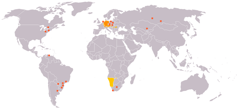
English: Legend:
Deutsch: Legende:
Français : Carte du monde où on parle l'allemand.
עברית:
Italiano: Legenda:
Nederlands: Beschrijving:
Svenska: Beskrivning:
|
||||||||
| 碼 | en:Image:Map_German_World.png | ||||||||
| 作者 | en:User:Ilario. | ||||||||
| 准 (重用此檔案) |
我,本作品的著作權持有者,決定用以下授權條款發佈本作品:
您可以選擇您需要的授權條款。 |
||||||||
| 其他版本 | File is obsolete! Use File:Legal statuses of German in the world.svg instead. |

檔誌
揀日尋檔。
| 日時 | 縮 | 度 | 用戶 | 註 | |
|---|---|---|---|---|---|
| 今 | 二〇二〇年七月一八日 (六) 二〇時三五分 | | 一三五七矩六二八(三六 KB) | Maphobbyist | South Sudan and Montenegro borders |
| 二〇〇七年一一月一一日 (日) 〇九時一四分 |  | 一三五七矩六二八(四六 KB) | Domaleixo | ||
| 二〇〇六年七月二七日 (四) 一八時二八分 |  | 一三五七矩六二八(二五 KB) | Cwlq~commonswiki | ||
| 二〇〇六年六月二八日 (三) 〇六時一八分 |  | 一三五七矩六二八(三七 KB) | Highpriority | {{Information |Description=en: Legend: *Orange: native language *Gold: Secondary language or non-official. *Red-orange square: German minorities de: Legende: *dunkles Orange: Amtssprache/Muttersprache *helles Orange: Zweitsprache oder nicht offiziel |
檔所繫者
無頁連本檔也。
總文之用
下他共筆連本檔:
- de.wikipedia.org上之用
- fr.wikipedia.org上之用
- incubator.wikimedia.org上之用