
檔案:U.S. Territorial Acquisitions-zh-classical.png
全幅 (微格三九六〇矩三〇六〇,度:二點四九 MB,多用網際網路副檔名之型:image/png)
| 述 |
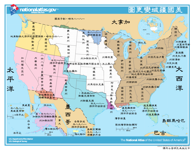
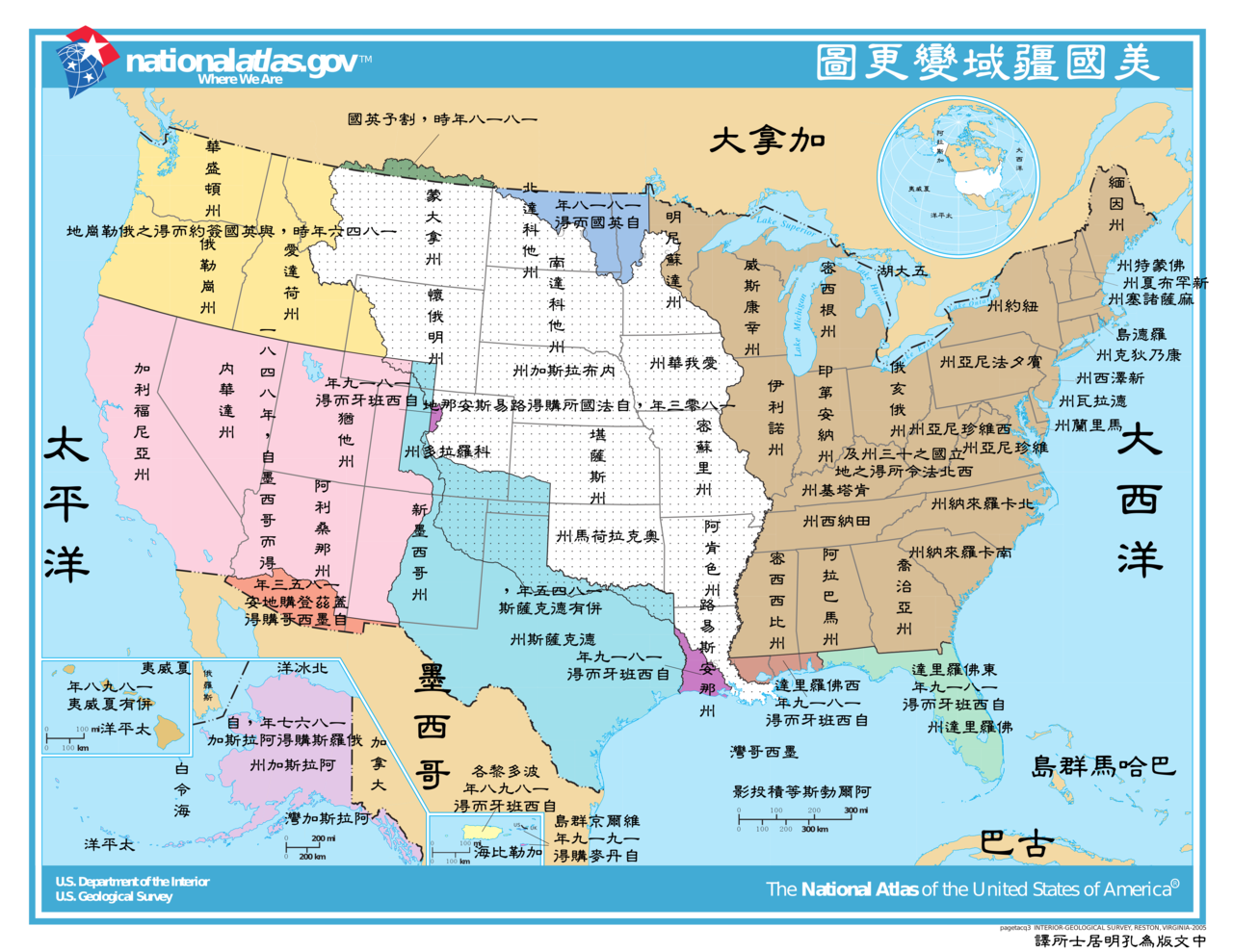
This image depicts the Territorial acquisitions of the United States, such as the Thirteen Colonies, the Louisiana Purchase, British and Spanish Cession, and so on. ErrorsThis map uses incorrect terms in that Great Britain didn't exist as a political entity in 1818 or 1846, having been superseded by the United Kingdom following the Act of Union with Ireland in 1801. This map does not show the full extent of the Oregon Territory into what is now Canada. The map shows a portion of the en:Isle of Orleans as part of the West Florida (Spanish Cession) 1819, but the area south of Lake Pontchartrain and east of the Amite River were part of the Louisiana Purchase 1803 (from France). |
|||
| 碼 | National Atlas of the United States [1] | |||
| 作者 | United States federal government (The Classical Chinese Translation is made by User:Itsmine.) | |||
| 准 (重用此檔案) |
|
|||
| 其他版本 | English Version: Image:U.S. Territorial Acquisitions.png |
檔誌
揀日尋檔。
| 日時 | 縮 | 度 | 用戶 | 註 | |
|---|---|---|---|---|---|
| 今 | 二〇〇八年三月二日 (日) 一〇時五一分 |  | 三九六〇矩三〇六〇(二點四九 MB) | Itsmine | |
| 二〇〇八年三月二日 (日) 〇九時三九分 |  | 三九六〇矩三〇六〇(二點五 MB) | Itsmine | {{Information| |Description= This image depicts the Territorial acquisitions of the United States, such as the Thirteen Colonies, the Louisiana Purchase, British and Spanish Cession, and so on. === Er |
檔所繫者
下頁連本檔有2: