
檔案:Seto Inland Sea satellite.jpg

覽幅:寛八〇〇高五四四微格。 他晰:寛三二〇高二一八微格|寛六四〇高四三五微格|寛一〇二四高六九六微格。
全幅 (微格一〇二四矩六九六,度:二四二 KB,多用網際網路副檔名之型:image/jpeg)
| 述 |
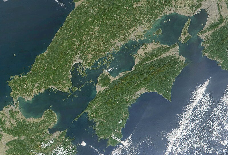
日本語: 瀬戸内海 Seto-naikai
Deutsch: Die Seto-Inlandsee ist ein Binnenmeer das die japanischen Inseln Honshū, Shikoku und Kyūshū voneinander trennt.
English: Formally named the Seto Inland Sea, the Inland Sea is the body of water separating Honshū, Shikoku, two of the main islands of Japan, and Kyūshū. |
| 期 | |
| 碼 | Cropped from: http://visibleearth.nasa.gov/view_rec.php?id=2206 |
| 作者 | Jacques Descloitres, MODIS Land Rapid Response Team, NASA/GSFC |
| 本作品由NASA創作,屬於公有領域。根據NASA的版權政策:“NASA的創作除非另有聲明否則不受版權保護。”(參見:Template:PD-USGov/zh,NASA版權政策或JPL圖像使用政策) | ||
 |
警告:
|
檔誌
揀日尋檔。
| 日時 | 縮 | 度 | 用戶 | 註 | |
|---|---|---|---|---|---|
| 今 | 二〇〇四年一一月二二日 (一) 二一時二一分 | | 一〇二四矩六九六(二四二 KB) | Tsui | Japan, the Seto inland-lake |
檔所繫者
下頁連本檔有2:
總文之用
下他共筆連本檔:
- en.wikipedia.org上之用
- fr.wikipedia.org上之用
- it.wikivoyage.org上之用
- ja.wikipedia.org上之用
- ja.wikibooks.org上之用
- ko.wikipedia.org上之用
- pl.wiktionary.org上之用
- tr.wikipedia.org上之用
- www.wikidata.org上之用
- wuu.wikipedia.org上之用
- zh-min-nan.wikipedia.org上之用
- zh.wikipedia.org上之用