
檔案:Cochise County Incorporated and Unincorporated areas Tombstone highlighted.svg

此 SVG 檔案的 PNG 預覽的大小:寛八〇〇高五六五微格。 他晰:寛三二〇高二二六微格|寛六四〇高四五二微格|寛一〇二四高七二三微格|寛一二八〇高九〇四微格|寛二五六〇高一八〇七微格。
全幅 (SVG檔,貌有像素八五〇矩六〇〇,幅五〇 KB)
概
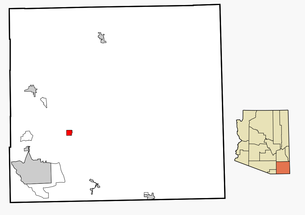
| 述 | This map shows the incorporated areas and unincorporated areas in Cochise County, Arizona. Tombstone is highlighted in red. Incorporated cities are shown in gray and unincorporated communities or CDPs are shown in white. Data for the borders and locations are based on files from the SouthEastern Arizona Governments Organization HPMS Maps and Records and maps from the US Census Bureau TIGER Map Server. I created this map in Inkscape. |
| 期 | |
| 碼 | My own work, based on public domain information |
| 作者 | Ixnayonthetimmay |
| 准 (重用此檔案) |
Copyleft-type licensing. See below. |
| 其他版本 | See Category:Maps of Cochise County for other versions of this image. |
權
| 我,此作品的版權所有人,釋出此作品至公共領域。此授權條款在全世界均適用。 這可能在某些國家不合法,如果是的話: 我授予任何人有權利使用此作品於任何用途,除受法律約束外,不受任何限制。 |
檔誌
揀日尋檔。
| 日時 | 縮 | 度 | 用戶 | 註 | |
|---|---|---|---|---|---|
| 今 | 二〇〇七年二月二七日 (二) 一八時二〇分 | | 八五〇矩六〇〇(五〇 KB) | Ixnayonthetimmay | {{Information |Description=This map shows the incorporated areas and unincorporated areas in Cochise County, Arizona. Tombstone is |
檔所繫者
下頁連本檔:
總文之用
下他共筆連本檔:
- ar.wikipedia.org上之用
- bn.wikipedia.org上之用
- ca.wikipedia.org上之用
- ceb.wikipedia.org上之用
- cy.wikipedia.org上之用
- de.wikipedia.org上之用
- eu.wikipedia.org上之用
- fa.wikipedia.org上之用
- fi.wikipedia.org上之用
- fr.wikipedia.org上之用
- ht.wikipedia.org上之用
- id.wikipedia.org上之用
- it.wikipedia.org上之用
- pt.wikipedia.org上之用
- ro.wikipedia.org上之用
- sr.wikipedia.org上之用
- tt.wikipedia.org上之用
- www.wikidata.org上之用
- zh-min-nan.wikipedia.org上之用
- zh.wikipedia.org上之用